Sights
Although the area of Sykies began to be populated massively in the first quarter of the 20th century, there are nevertheless evidences of a continuous human presence, already from the pre-Christian period.
Symbol of the region is the Eptapyrgio (Yendi Koule), the Byzantine Acropolis of Thessaloniki, along with the walls that were part of the city's fortifications.
In Pefka, on the borders of the Municipality, there are preserved Byzantine watermills that used the water that arrived from Hortiatis, while in the settlement of Kallithea an important find is a marble inscribed slab, probably from a Roman sarcophagus of the 2nd BC. century.
In the district of Rodochori, the imposing Monument of the Asia Minor Cappadocian refugees stands out, as well as a characteristic Ottoman fountain, while in the center of Neapoli, Peace Square hosts the most famous meeting point, the "Clock".
The area of the Municipality has two important green and well-being “lungs”, the grove "Dendrophytia" and the forest of Sheikh-Sou. A place with rich cultural activity, it has a lot of infrastructure but also two Museums, the Museum of Refugee Hellenism and the Museum of History.
SIGHTS OF SYKIES
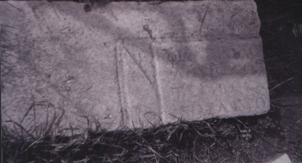
Marble slab, probably from a 2nd century AD sarcophagus, with an inscription inside a tabula ansata. It was walled off in 1978 from the ruins of the "Mount Sinai" tavern, in the area of the "Mevlehane" settlement.
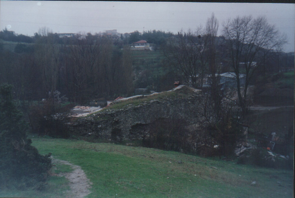
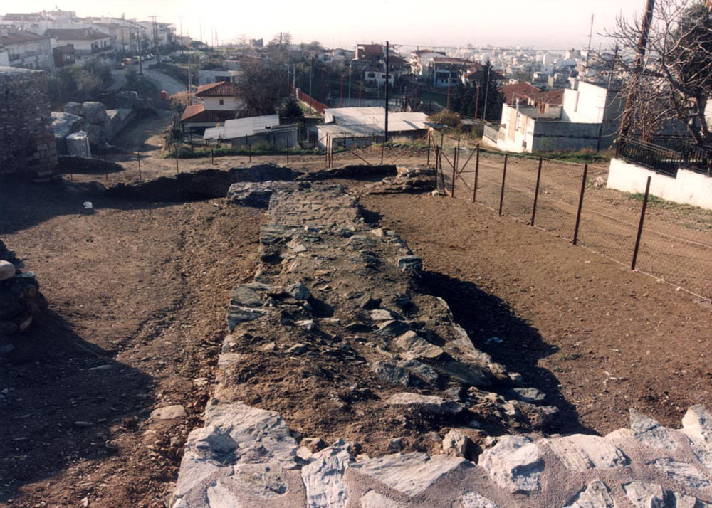
Remains of a Byzantine watermill at the "Retziki" site.
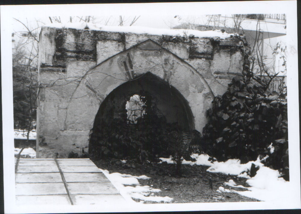
Fountain from the years of the Turkish occupation in the "Rodochori" settlement.
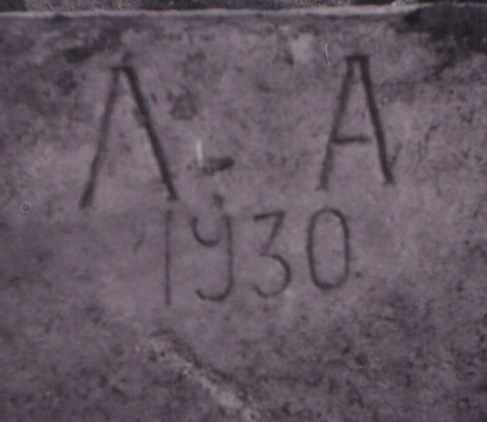
The back view of the 2nd century AD marble slab, with a newer inscription, bearing the date "1930".
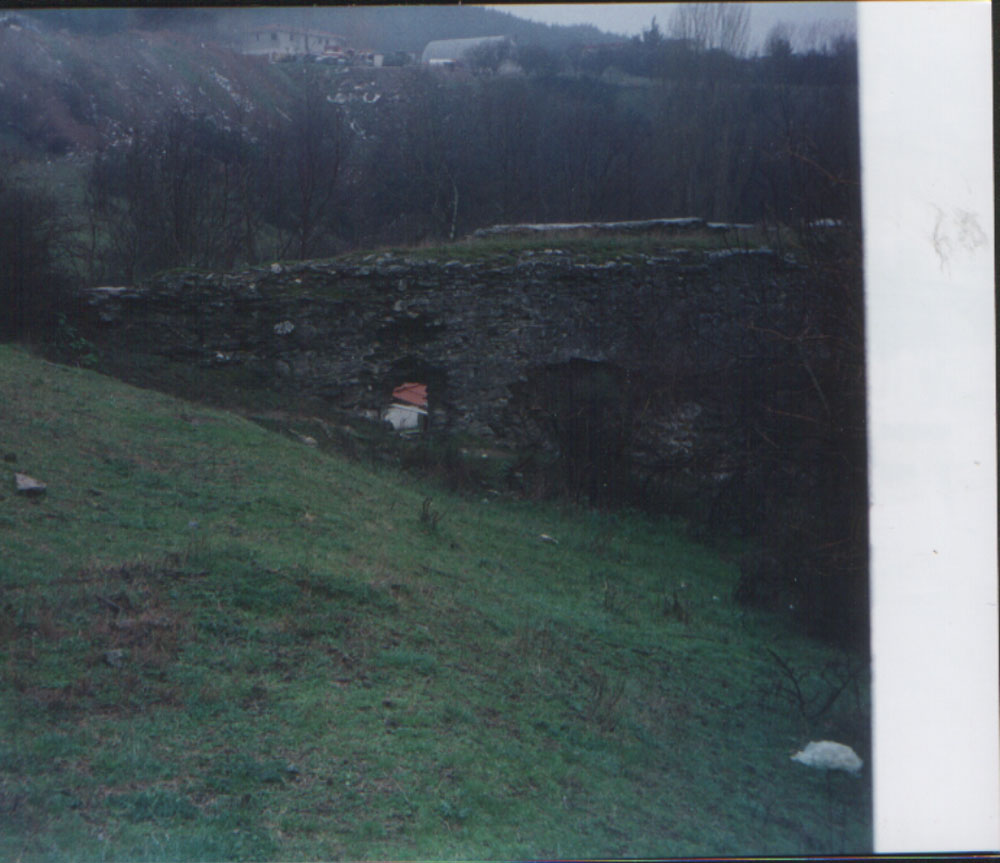
Remains of a Byzantine watermill at the "Retziki" site.
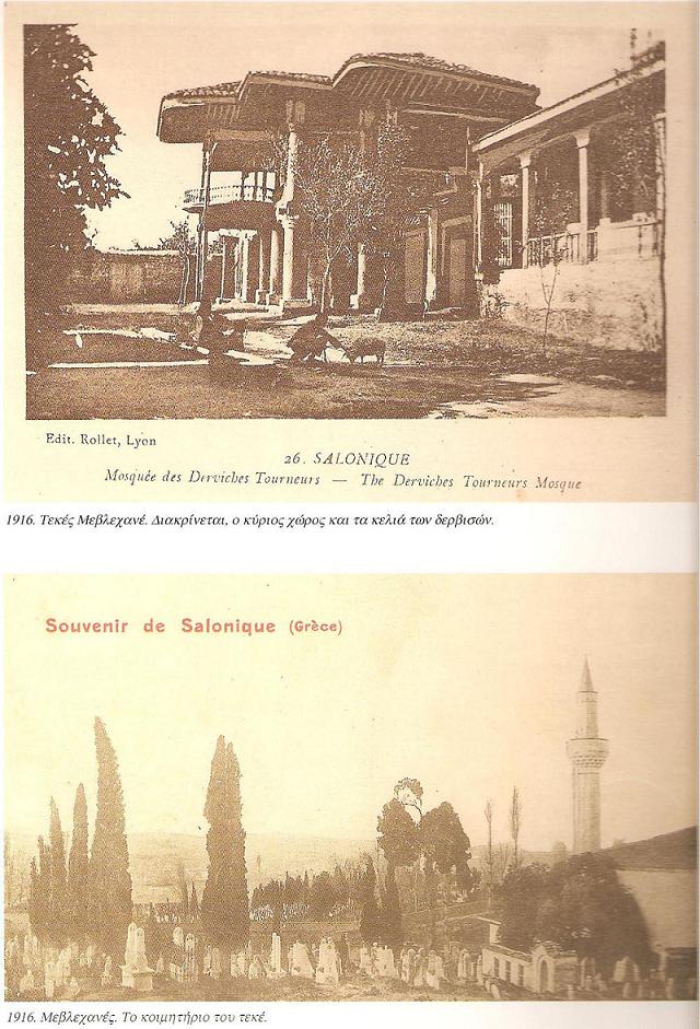
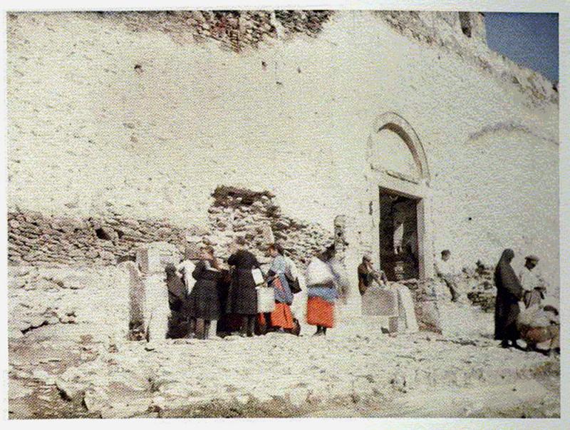
Dervish tekke, a Muslim religious house in the Kallithea region, on old postcards (1916). Above you can see the main area and the cells of the dervishes, while below the tekke cemetery.
EASTERN WALLS
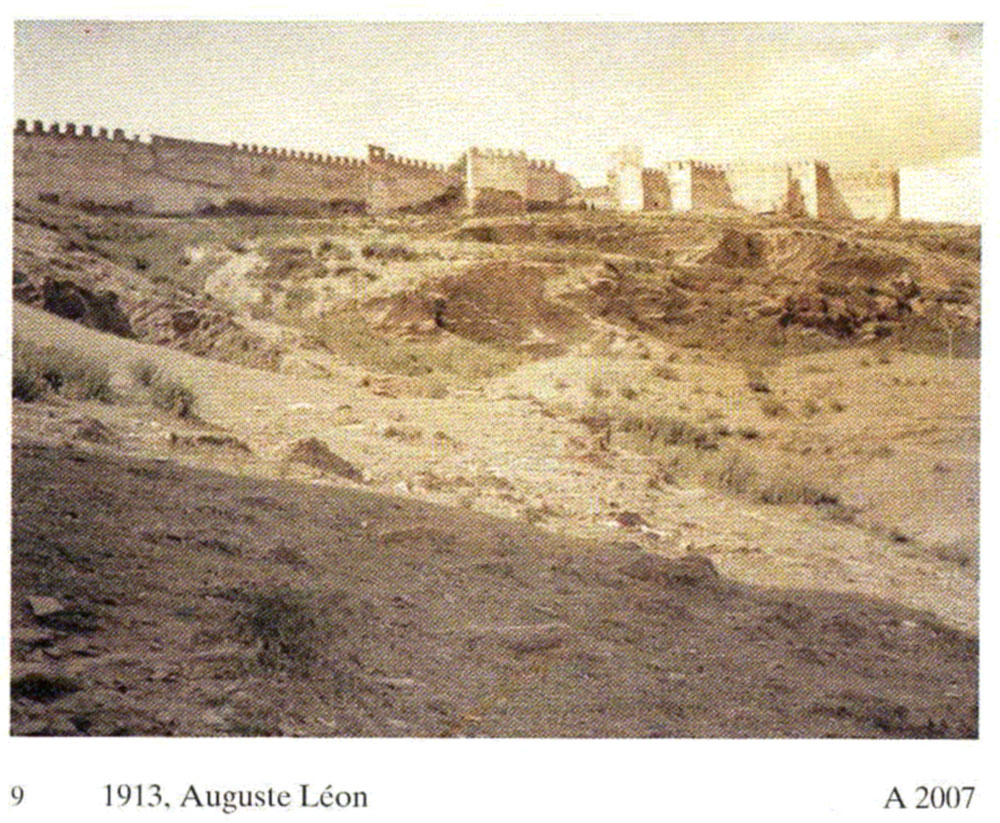
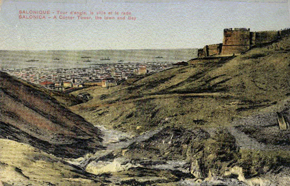
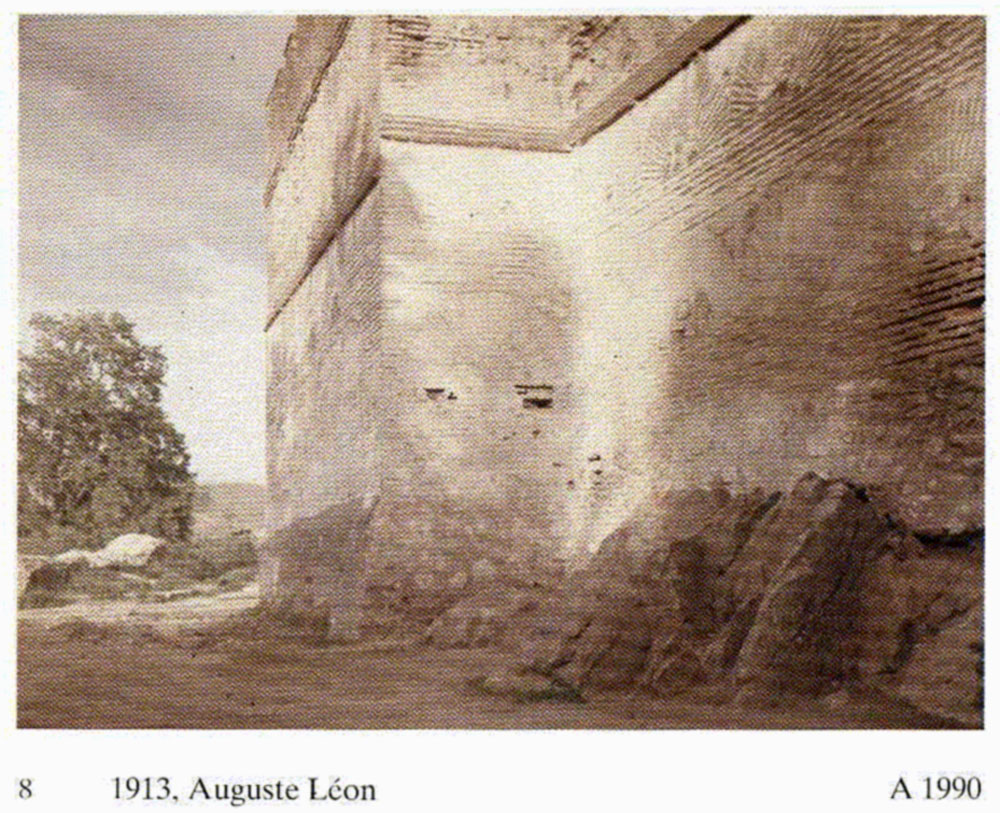
View of the eastern walls in a colored lithograph of 1913. Shot from the west.
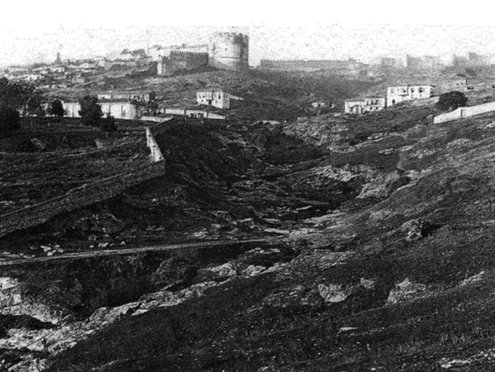
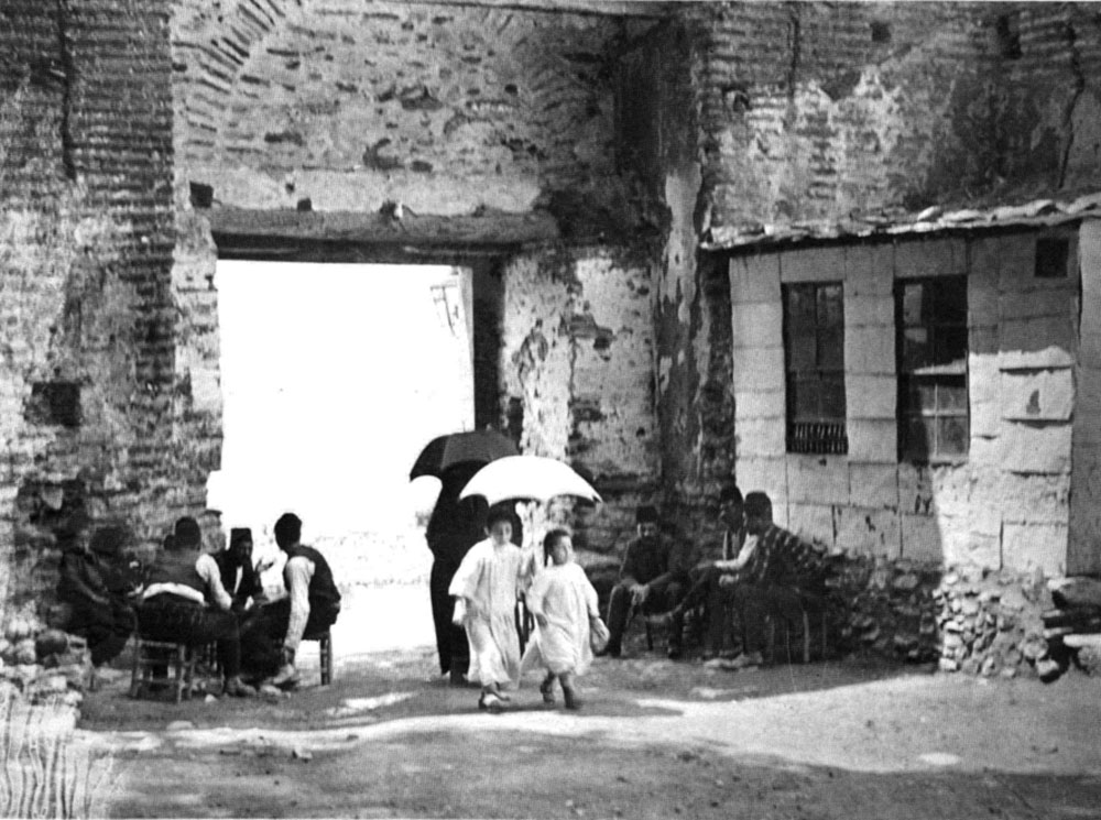
View of the area outside the eastern walls. Shot from the South.
View of the area outside the eastern walls in an early 20th century colored copperplate. Shot from the North.
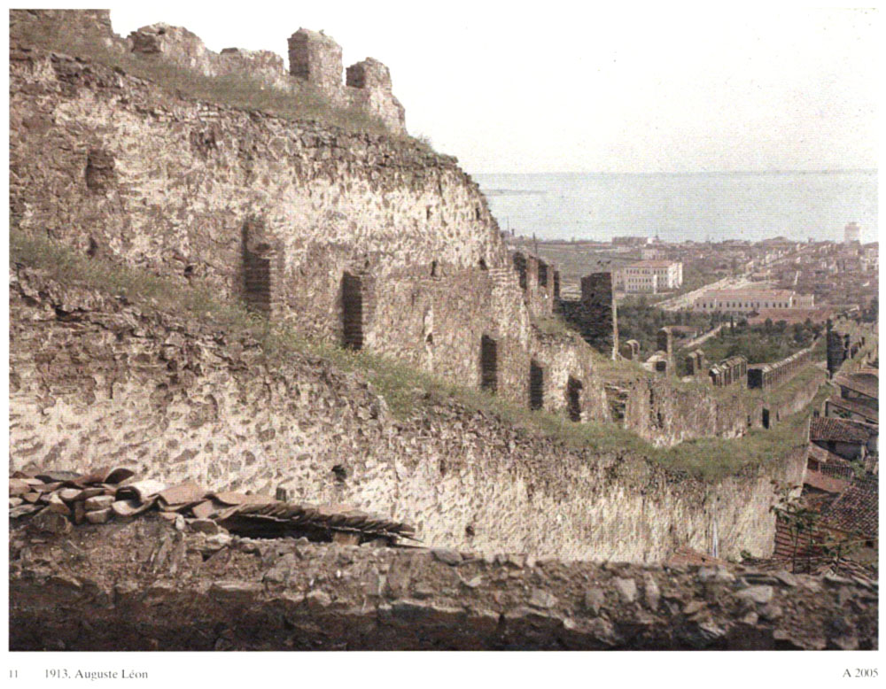
Part of the inner side of the eastern walls. Shot from the North.
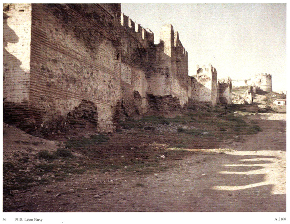
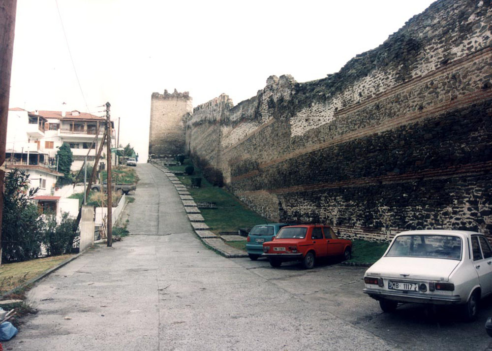
View of the eastern walls. Shot from the South, the Trigonio Tower can be seen in the background.
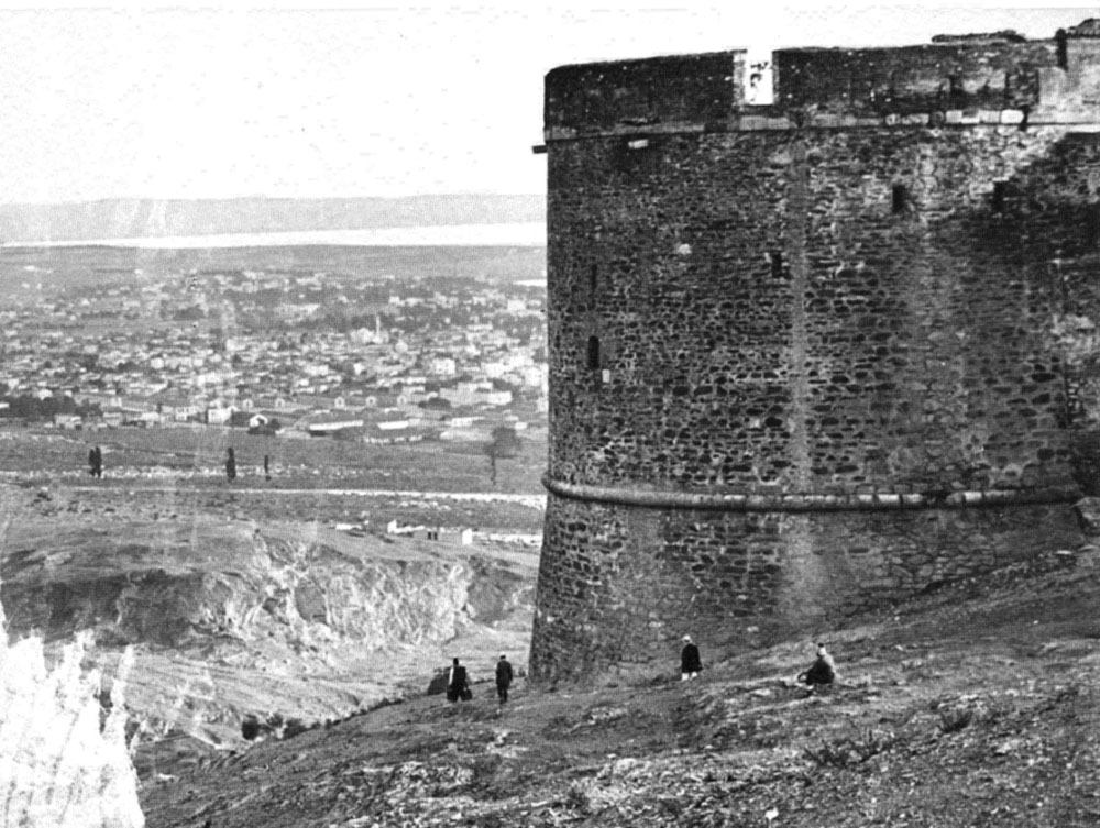
The Trigonio Tower at the northern end of the eastern walls. The city and the harbor can be seen in the background.
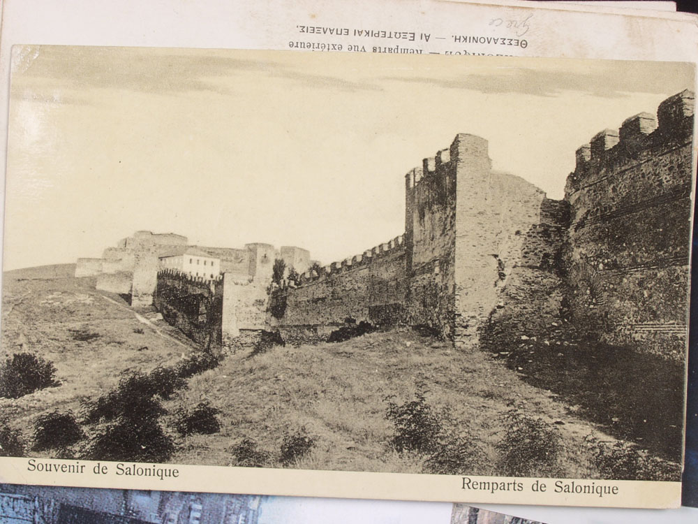
Eastern walls, the area around the Trigonio Tower in an early 20th century postcard.
Eastern walls, the area around the Trigonio Tower in an early 20th century postcard.
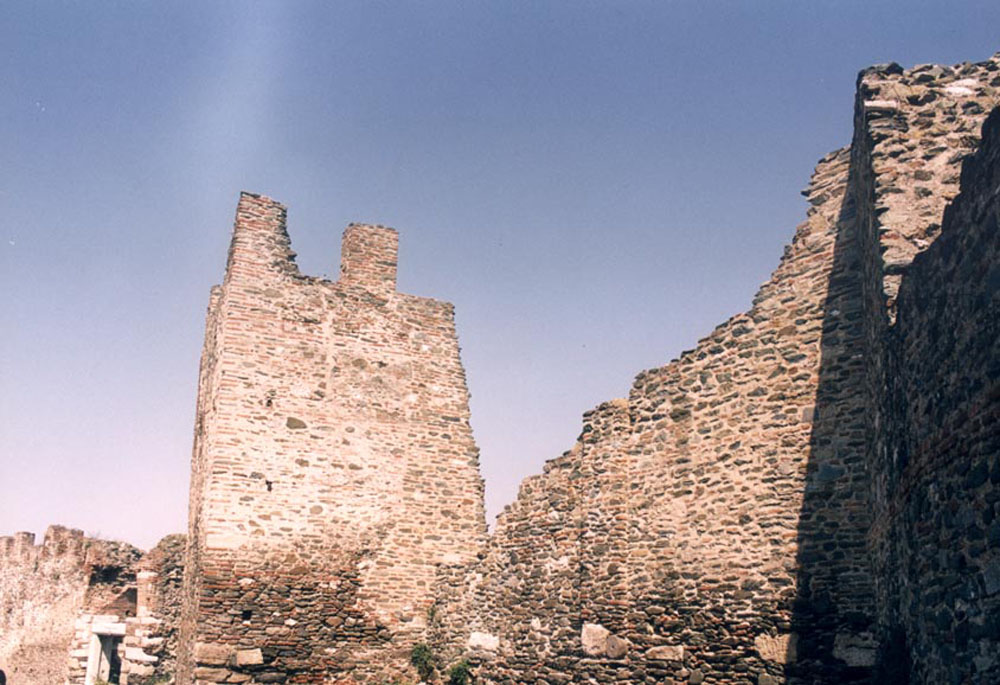
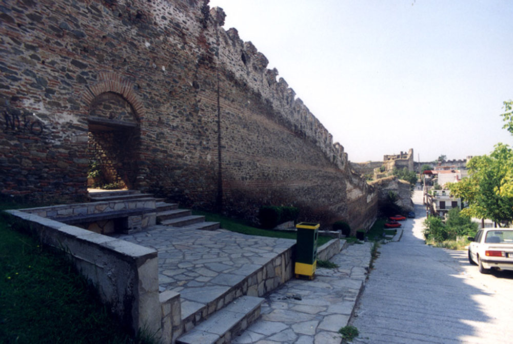
Part of the eastern walls, above the "Agios Dimitrios" hospital.
NORTHWESTERN WALLS
Detail of the western walls in a 1913 colored copperplate.
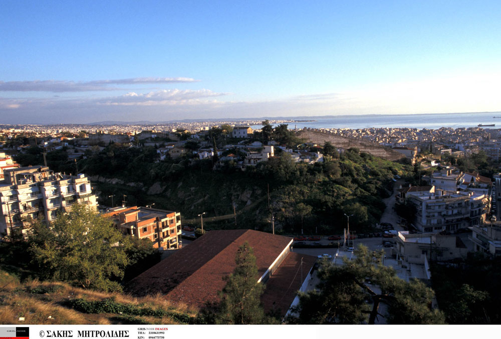
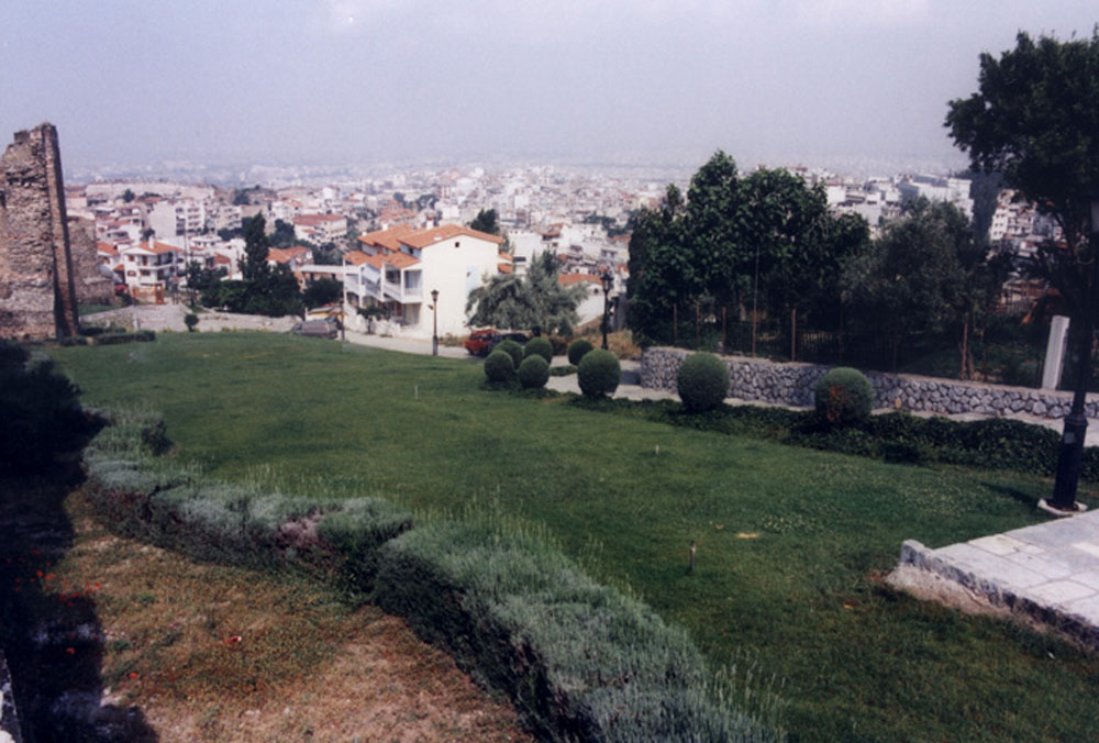
Panoramic view of Thessaloniki from Sykies Town Hall building. On the first level, part of the northwestern walls can be seen.
Part of the western walls in an early 20th century photograph.
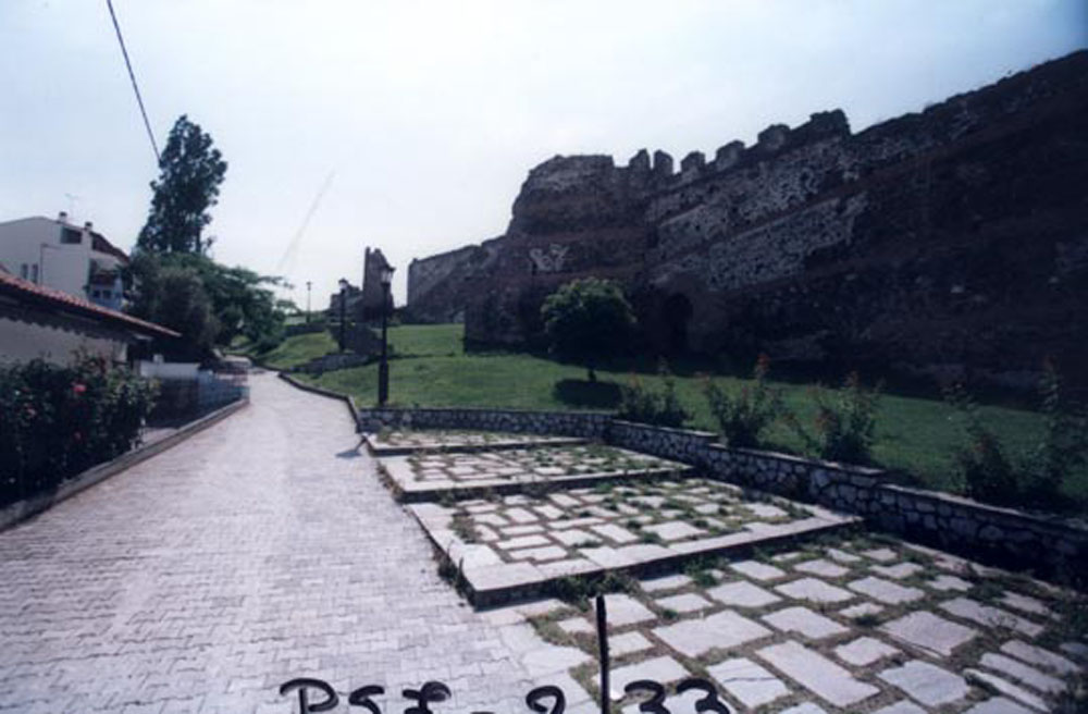
Part of the northwestern walls in the Evros Sector. Long shot from the area of the current Sykies Town Hall building.
Semi-damaged part of the northwestern walls in the area of the Evros Sector.
Semi-damaged part of the northwestern walls in the area of the Evros Sector.
Semi-damaged part of the northwestern walls in the area of the Evros Sector.
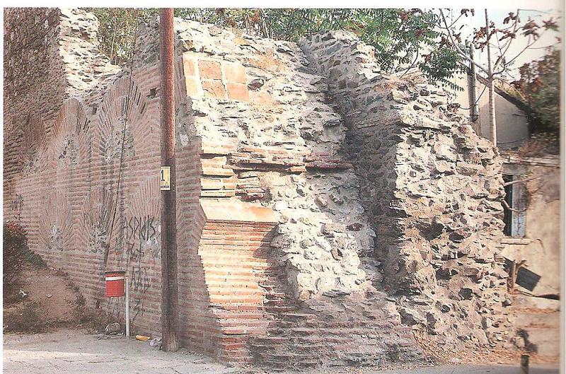
Part of the northwestern wall on Sahtouri Street. Externally, the early Christian fortification can be seen, after the recent repairs, and internally, the Roman one, in contact.
Part of a wall from the early Christian period, west of the Claudian tower.
ACROPOLIS
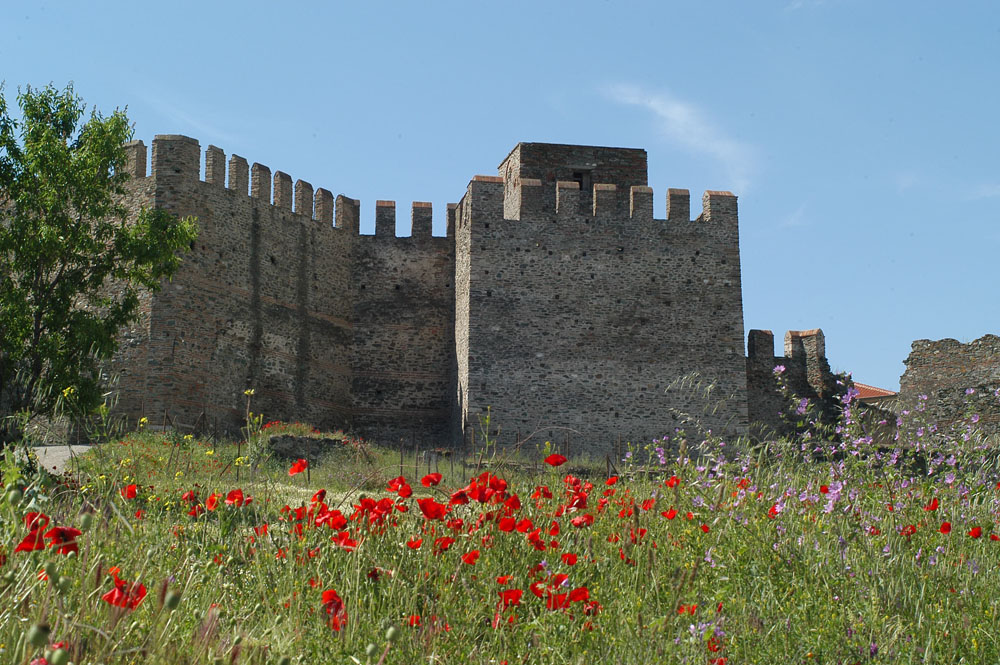
General view of the Acropolis. Shot from the southwest, Eptapyrgio can be seen in the background.
Western walls of the Acropolis, Eptapyrgio can be seen in the background.
Part of the northern walls and secondary gate in the Vlatadon Monastery area.
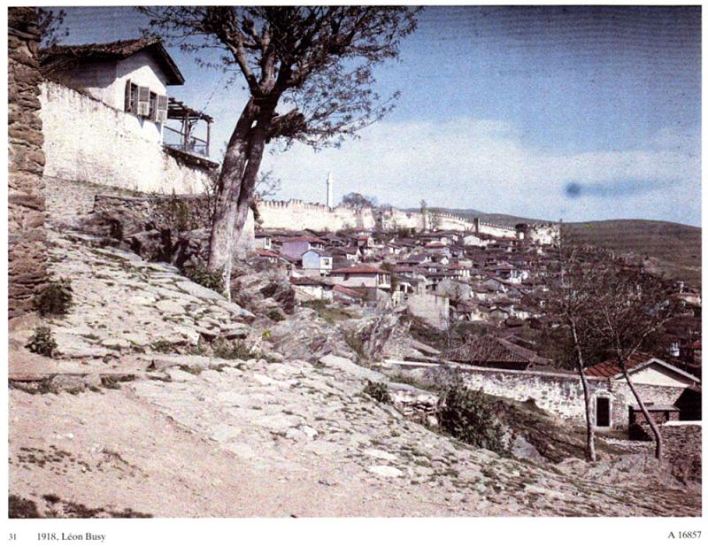
View of the Ano Poli (Upper Town) from the Vlatadon Monastery area.
Gate in the wall of the Acropolis, known as "Portara" (early 20th century).
Part of the area outside the western wall of the Acropolis.
Space configuration outside the western wall of the Acropolis.
Space configuration outside the western wall of the Acropolis.
Part of the outer side of the western wall of the Acropolis, in the area of the 1st Primary School.
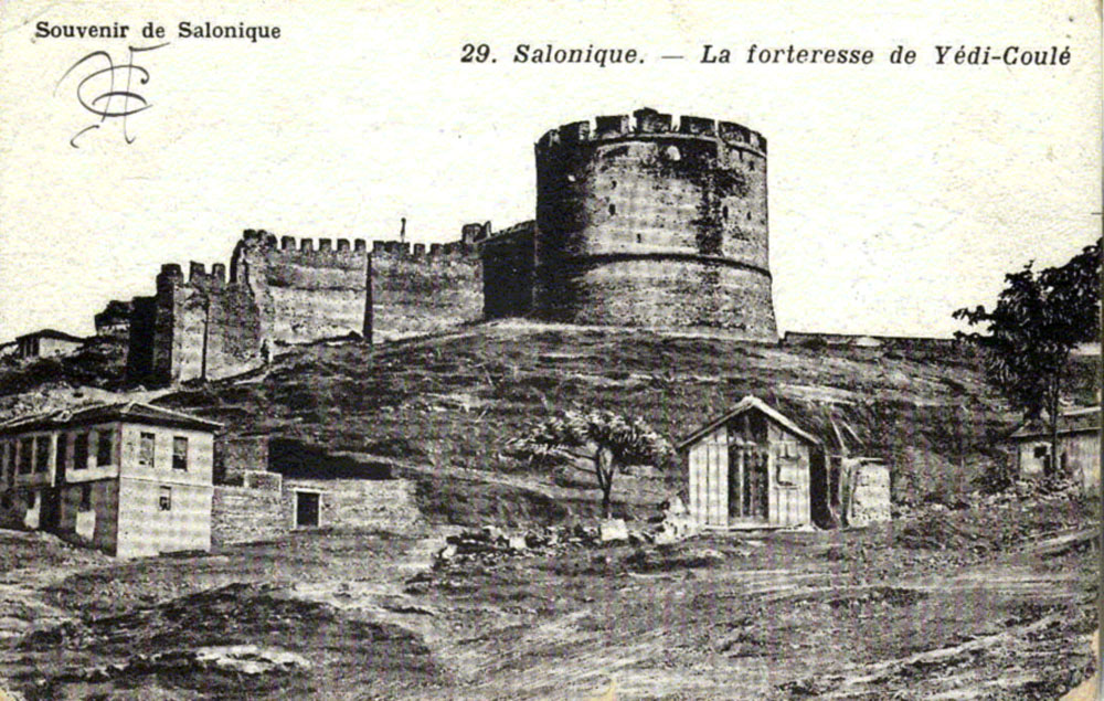
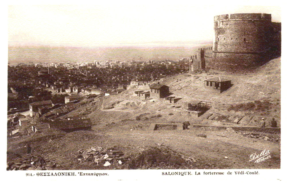
EPTAPYRGIO (SEVEN TOWERS)
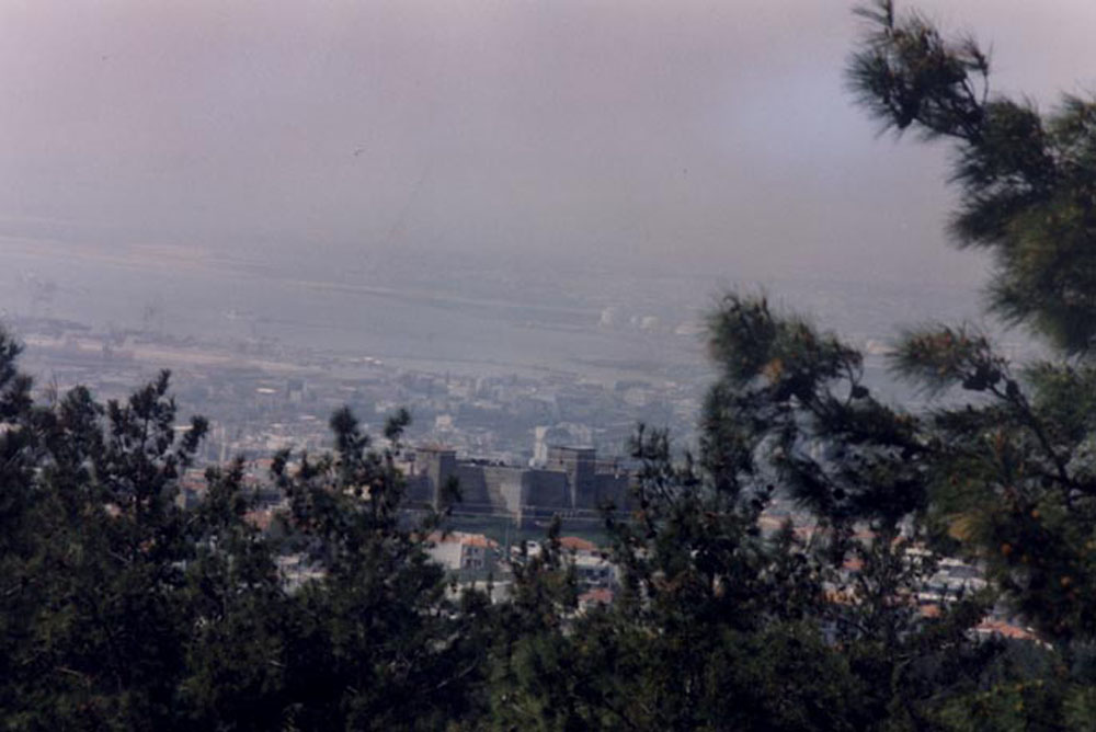
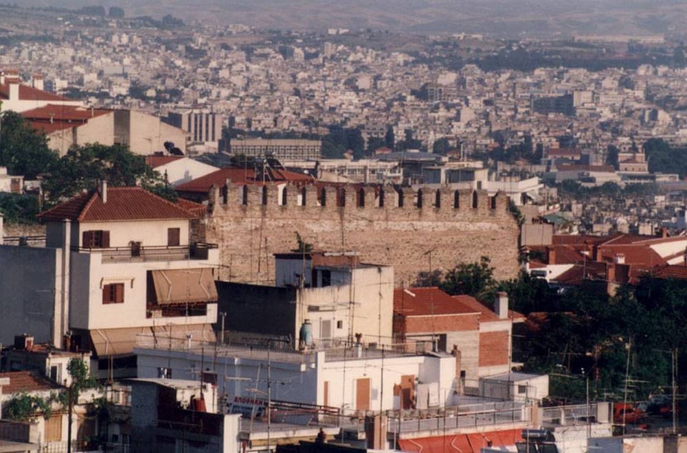
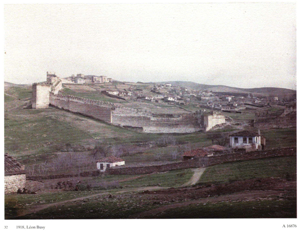
General view of Thessaloniki from the Hill of Philippion. On the first level, Eptapyrgio can be seen.
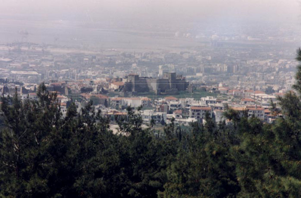
General view of Thessaloniki from the Hill of Philippion. On the first level, Eptapyrgio can be seen.
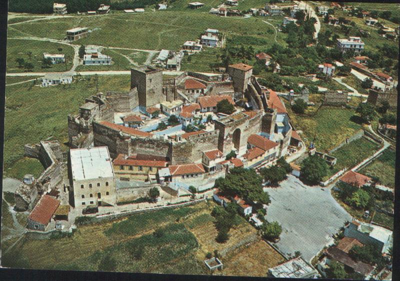
Eptapyrgio, aerial photo.
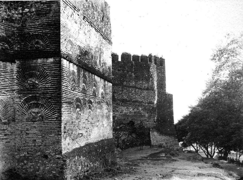
General view of Eptapyrgio from the northwest.
General view of Eptapyrgio from the northwest.
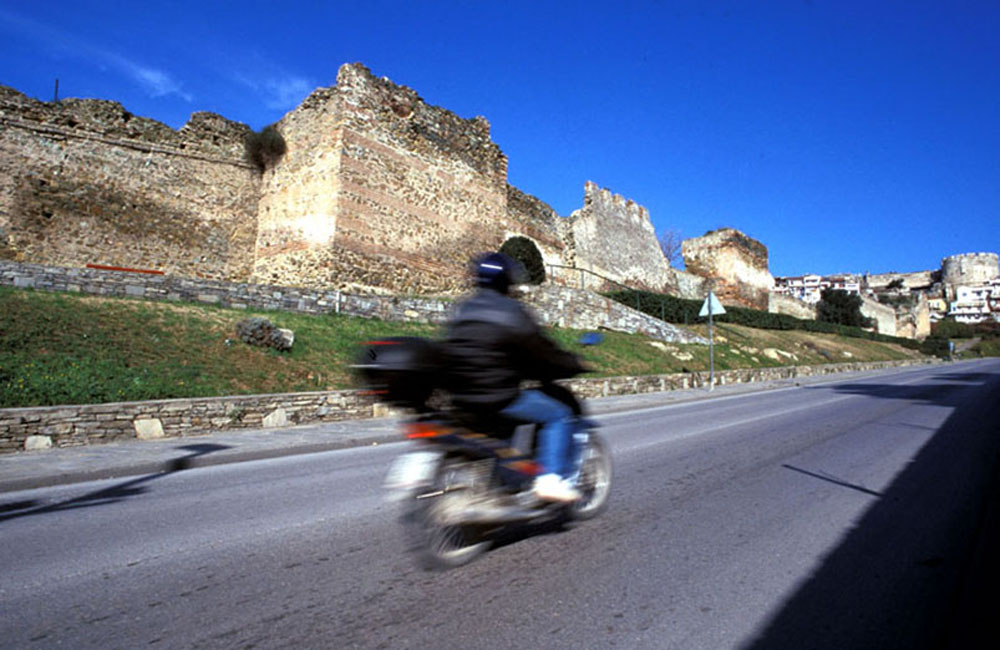
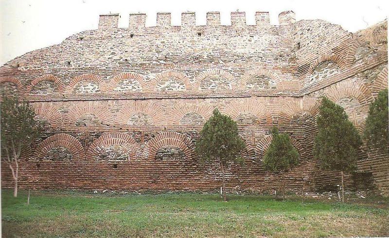
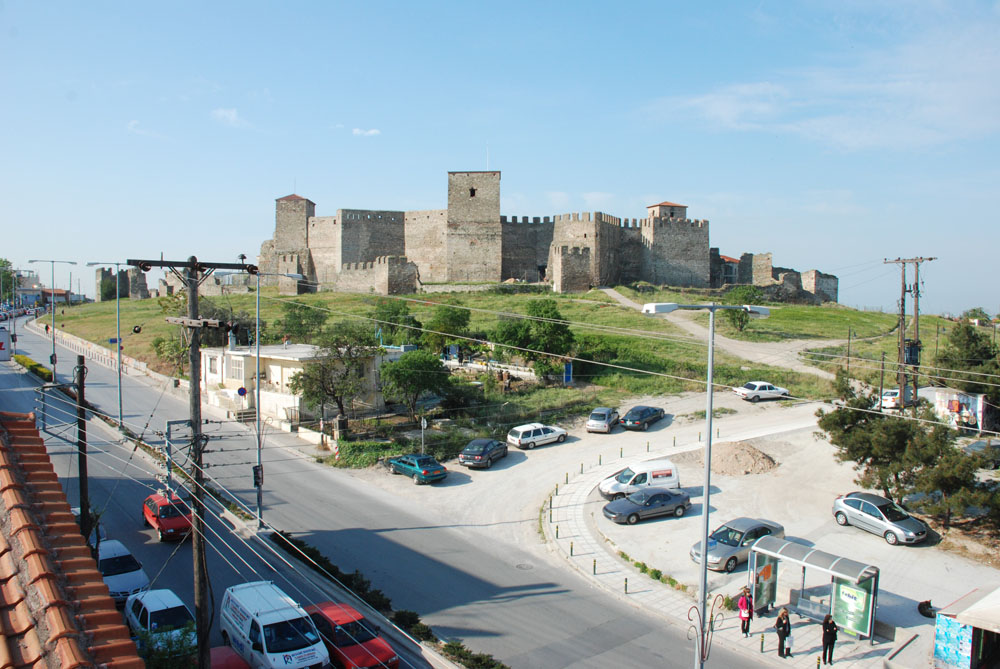
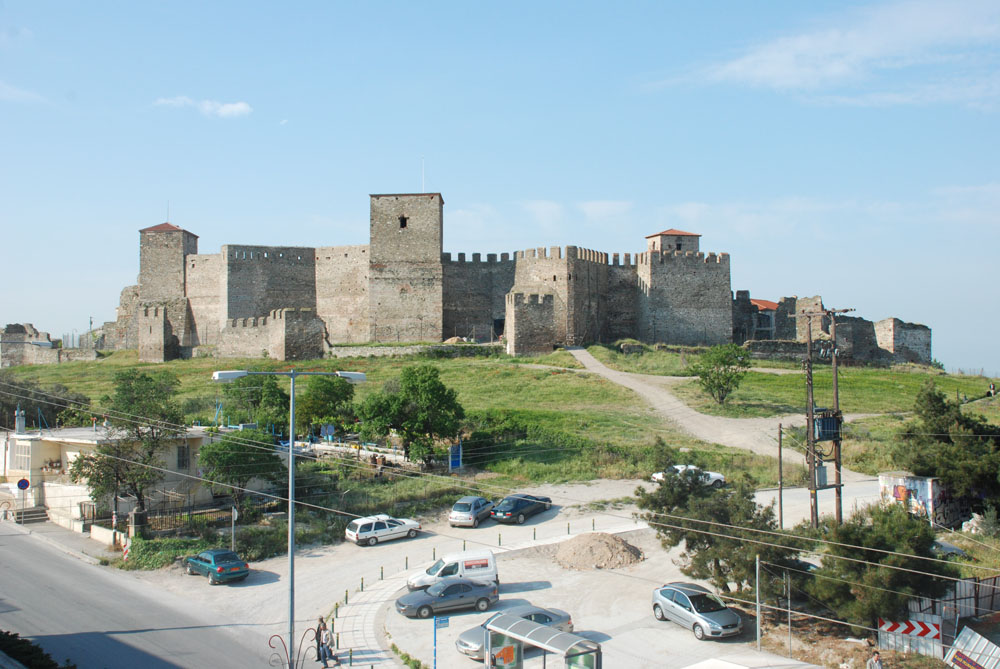
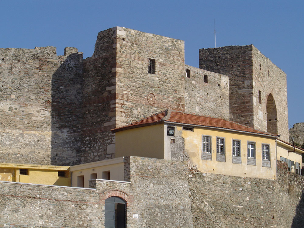
Modern view of Heptapyrgio. Shot from Southwest.
Modern view of Heptapyrgio. Shot from Southwest (detail).
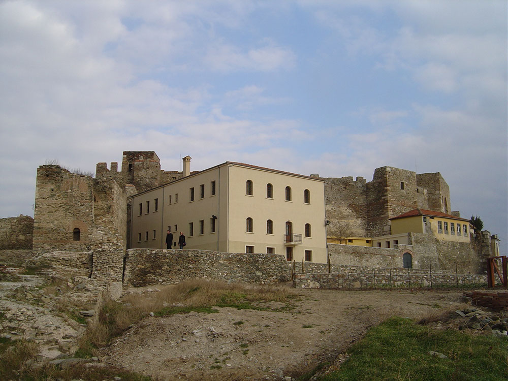
Part of the southern precinct of the Eptapyrgio precinct (detail).
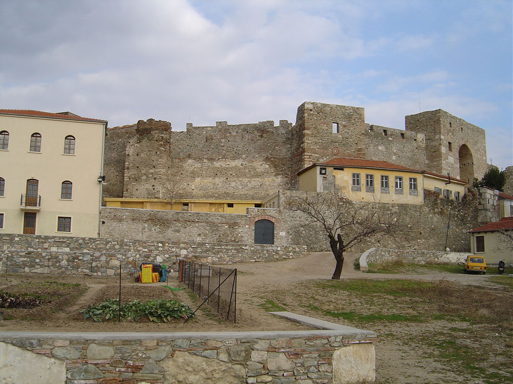
Part of the northwestern precinct of Eptapyrgio (detail).